BadwaterJournal.com
WHAT UNSUSTAINABLE URBAN GROWTH LOOKS LIKE

BadwaterJournal.com
WHAT UNSUSTAINABLE URBAN GROWTH LOOKS LIKE
Published online at Louisville, Kentucky USA -
An independent, secular, contemporary journal of political and environmental issues dedicated to peaceful reduction of human impacts on Earth

FORD must adapt to Climate Change HERE
Transportation Re-funding and Ultra-fine particulate HERE
20 Year Housing Plan as an apology for slavery HERE
The Mass Psychology of Racism HERE
Move Louisville HERE
Tree Protection HERE
JCPS Bus pollution HERE
Race disproportionate
unemployment HERE
Road Salt runoff HERE
West End History HERE
Poverty and Crime HERE
Highway Trust Fund HERE

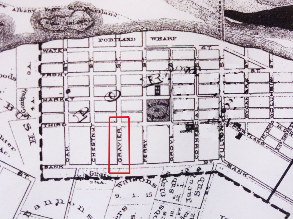
PORTLAND WHARF
Place of profound historical significance abandoned to motorized off road riders, Combined Sewer Overflows
and junk dumpers
The Portland Wharf historic park shown in the map above from the Portland Master Plan, 2002
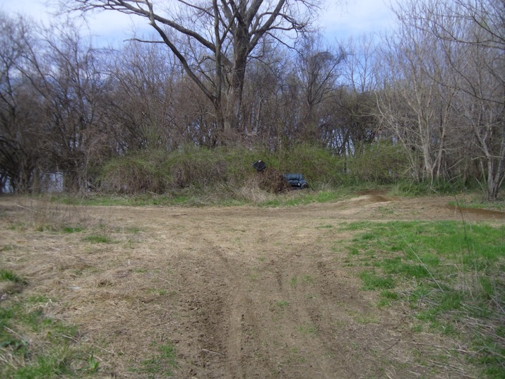
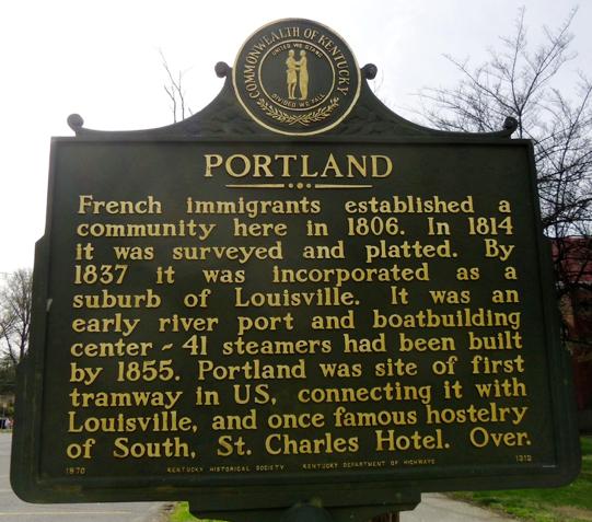
What could be the ‘French Quarter” of Louisville, the Portland settlement built between 1811 and 1830, is now razed to the ground, cut off from the adjacent neighborhood by a whining super highway (elevated I-64) and massive floodwall and abandoned to off road bikers who buzz-sawed the air with noise and smoking exhaust as we toured the area last Sunday. This historic jewel has so much potential but the Master Plan prepared for Metro Parks in 2002 to recapture some features doesn’t seem to be making progress.
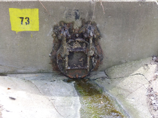
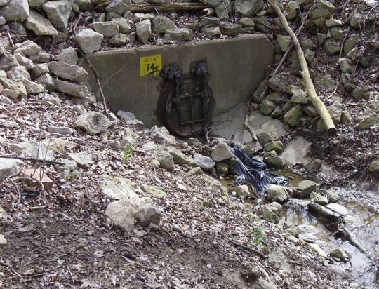
Effluent Channels: Two open effluent channels convey sewer overflow unsanitary wastewater across the park running north to discharge in the Ohio River. One of them is visible next to the dumped property to the right. This scene is adjacent to the Shawnee Golf Course.
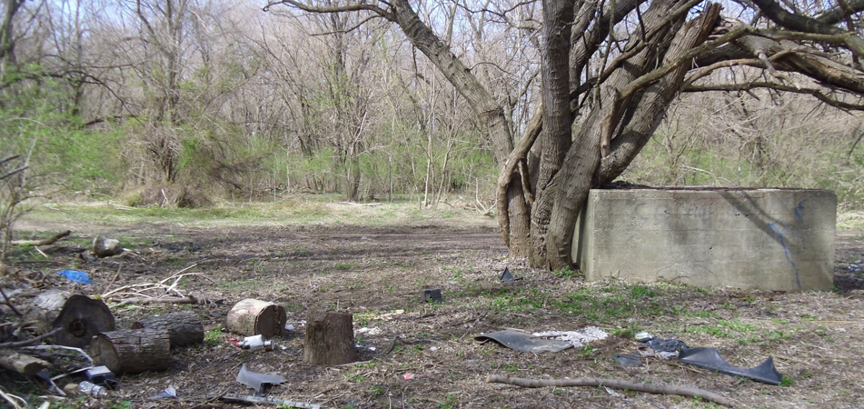
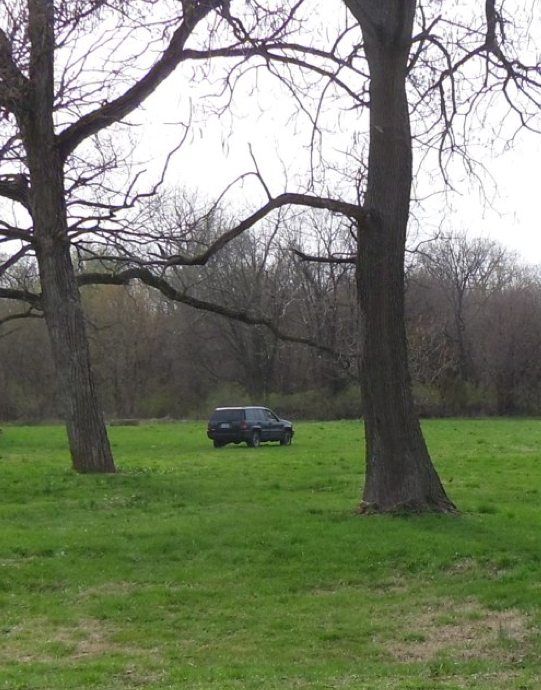
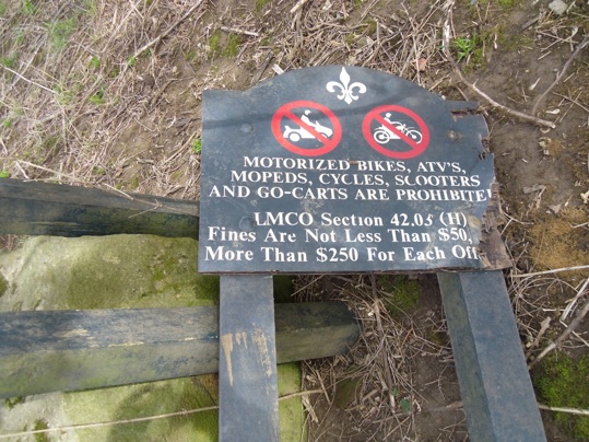
Off Road vehicles: The park is overrun with off road motor bikes and four wheel ATVs driven in from the local neighborhood. Cars came and went driving over the floodwall and across the green space as we walked. The wooded area features beautiful cottonwood trees surrounded by a glut of invasive woody honeysuckle bushes. The entire historic park is carved up with dirt tracks and mud wallows caused by motorized vehicles moving over rain soaked turf.
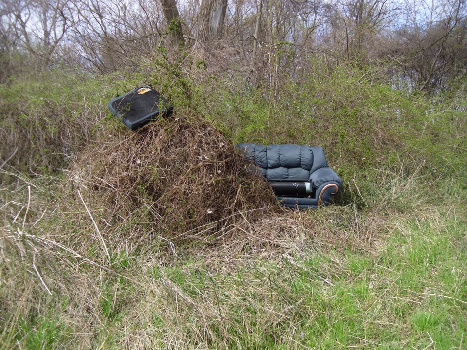
Dumping: Piles of freshly dumped domestic goods littered the area. Vehicle access to the area is evidently not monitored and the junk dumpers can come and go as they please. Below a couch peaks out of bushes near the river.
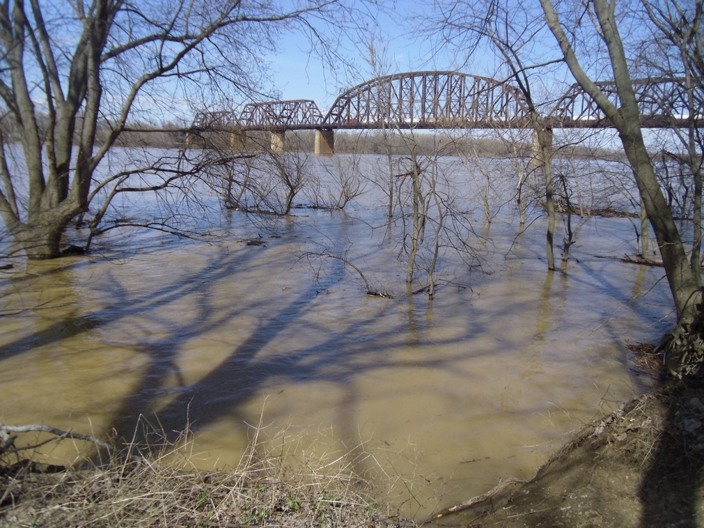
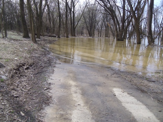
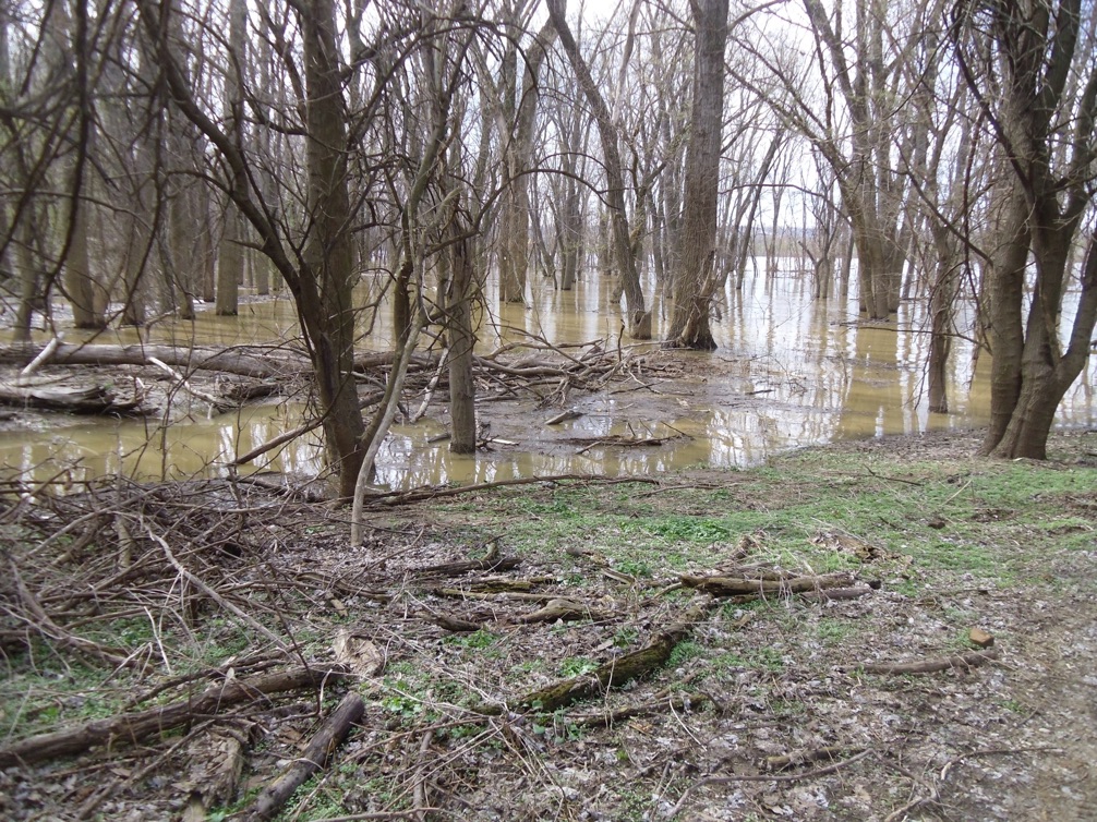
Flooding: The Riverwalk trail was submerged in part along the wooded river area. Part of the trail has been closed for more than a year along the Shawnee Park golf course where the steep drop off to the river collapsed.
History: Neighborhood groups have been working to revive and improve the Portland neighborhood and reconnect it to the larger city. Under discussion and championed by political candidate John Owen, is a Market Street Trolley Project that could excavate the buried trolley rails under the street and put an electric trolley back in service running east-west. This simple and inexpensive transportation improvement has been ignored by the elite city leaders who seem to compose a government of East Louisville. The current Move Louisville transportation chimera doesn’t include a project to excavate existing trolley tracks.
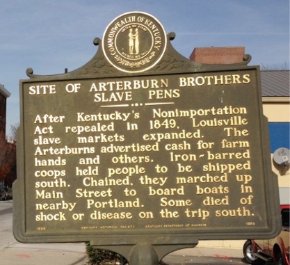
Slavery: The Portland area is the site of profound slavery injustice that should be hallowed ground, respected, marked with wayfinding information and restored for education about slavery’s profound impact on our culture. At the Portland Wharf, during the rise of the “King Cotton” slavocracy in the Mississippi Valley, black people were kept in slave pens before being boarded on steamboats to be “sold down the river’ into unpaid servitude. Thousands of slaves were auctioned and sold from Louisville and Lexington traders and put on boats here. In the newspapers of the 1850s-60s the advertisements can be read referring to offices in Portland.
A network of underground railroad abolitionists operated trying to cross slaves into Indiana and rowing between New Albany and Portland where a ferry boat crossed before the K&I Bridge was built. See: T. D. Clark,
The Slave Trade between Kentucky and the Cotton Kingdom, The Mississippi Valley Historical Review, Vol. 21, No. 3 (Dec., 1934), pp. 331-342
"Newspapers of the lower South carried equally as many advertisements for the slave dealers as did the Kentucky papers. On January 10, 1855, in the Semi-Weekly Creole of New Orleans Thomas Foster's advertisement stated that he was in a position to serve as commission merchant dealing in slaves, and invited his Kentucky friends to visit him in his office at 157 Common Street. In the same paper D. H. Mathews and Thomas J. Frisby were advertising slave pens located at 159 Gravier Street.”
Around 1831, the two dealers added a partner: Rice Carter Ballard, a man who originally made his home in eastern Virginia. Soon, the three partners were shipping as many as a thousand people per annum from Ballard's Richmond depot to New Orleans. Ballard paid operatives to scour the interior counties of the Virginia Piedmont, inquiring at run-down tobacco plantations and sheriff's sales for surplus labor to ship south and west.
The traders' participation in, and even manipulation of, a series of vast networks of financial and commercial exchange meant that they were well versed in the way that the world of production, trade, and consumption worked. They accumulated knowledge and expertise, and they accumulated profits as well. By the end of the 1830s, gains from the trade had enabled Isaac Franklin to settle in Tennessee on "Fairvue," one of several plantations that he now owned. This one was reputedly more impressive than his neighbor Andrew Jackson's, "The Hermitage." At his death, even in the depressed economic year of 1846, Franklin's estate still commanded a value of three-quarters of a million dollars. Ballard, meanwhile, retired to Louisville, Kentucky, with his new wife. There, he lived off the skimmings of seven plantations that he had accumulated in the Mississippi Delta during the boom decade of the 1830s and the hard times of the 1840s. With almost a thousand slaves to his name, Ballard had clambered to a pinnacle of wealth occupied by only a handful of others in the antebellum United States. The slave trade had brought these men wealth, facility and familiarity with their economic world, and status.”
From, Edward E. Baptist, "Cuffy," "Fancy Maids," and "One-Eyed Men": Rape, Commodification, and the Domestic SlaveTrade in the United States,
The American Historical Review, Vol. 106, No. 5 (Dec., 2001), pp. 1619-1650
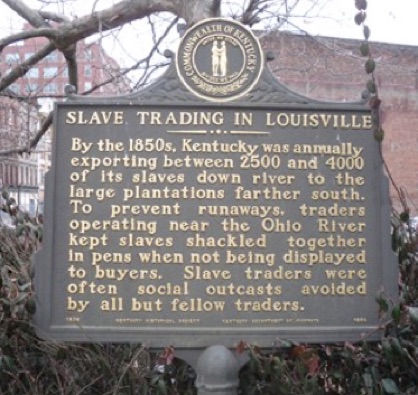
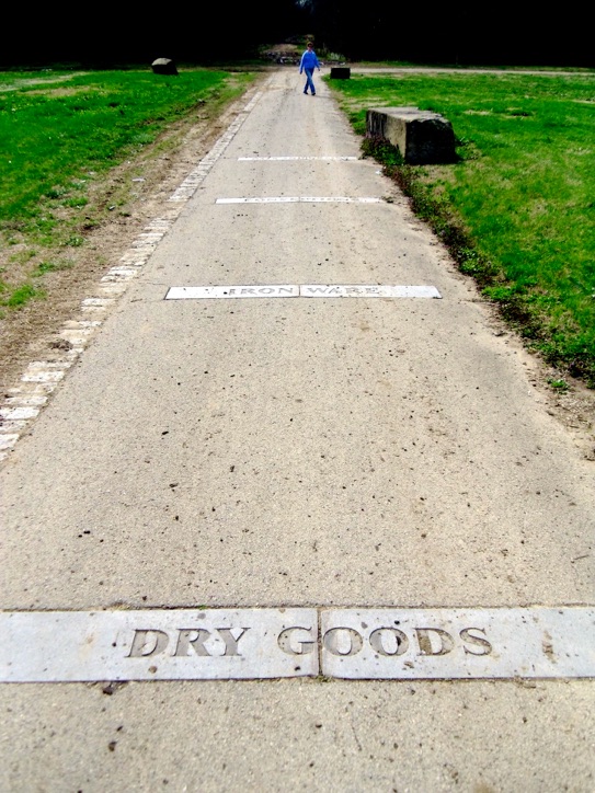
The River walk pavement insets are scrubbed of any slave history which is a curious omission. Downtown markers erected by the Kentucky Historical Society refer to Portland as the shipping point.
The area is rich with the kind of history that could induce millions of dollars of tourism industry and spark revival of the area if only the reigning East Louisville government would relent and allow some development along the natural contours. Instead, warehouses and WALMARTS seem to be the future. Recreation of a historical district and joined by a historic trolley, millions of dollars could end up in local pockets as Dertby Festival tourists enjoy attractions that honor and explain antebellum history.
Wasting this cultural asset is a mistake. The Vision Louisville process has to be examined through the lens of preserving and supporting the development of Portland and discovery the treasure of culture lying west of the 9th Street barrier. Low hanging fruit is rediscovering the magic of fixed rail trolley lines to tie together the Waterfront attractions all along the Ohio. So far no feasibility study has been performed to even determine how cheaply this fantastic tourism asset could be recovered. Louisville’s magic could be resparked if the jealous automaker leadership could be persuaded to take pity.
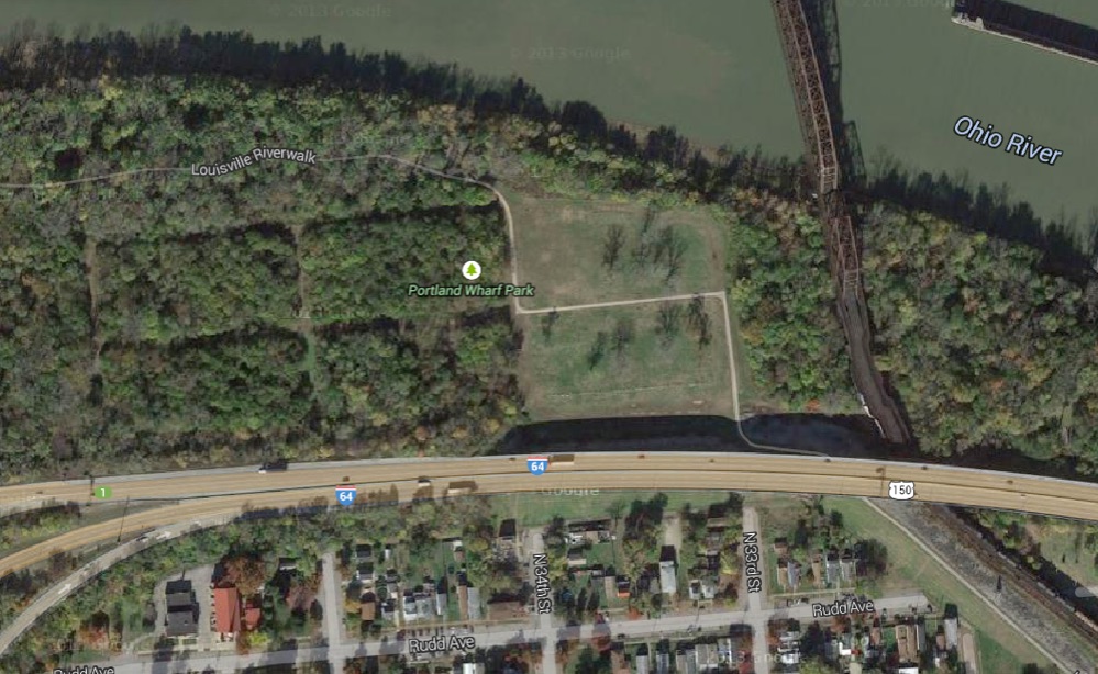
Google Map
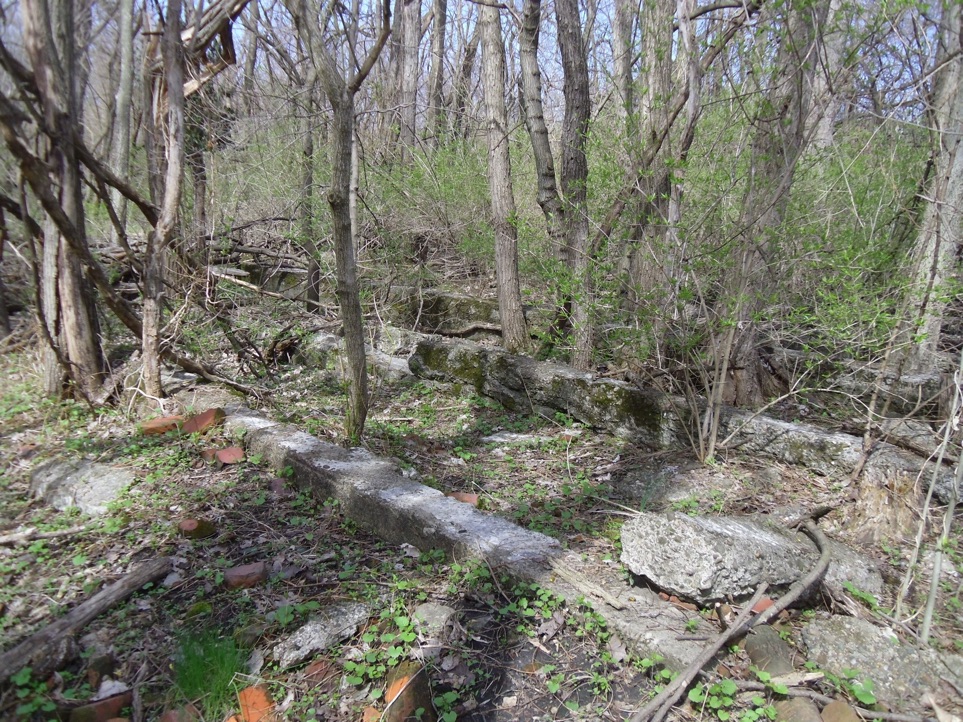
concrete foundations
old street layout
Combined Sewer Overflow effluent channels


Ruins of unidentified works
encroaching Ohio waters
Sewer Overflow
Car races across the park
Sign torn down
K&I Bridge started in 1910
so this map predates to 1800s
Map courtesy of Cynthia Cooke