Welcome to BadwaterJournal.com© INDEX PAGE for all articles
Are Louisville’s air quality cops looking the other way?
Metro Louisville has applied to be removed from federal non-attainment status for particulate matter pollution. Badwater looks at the air monitoring network and the air data produced.
Vehicular exhaust particles are found to be most responsible for small-sized airborne PM air pollution in urban areas.
In general, the evaluation of most of these studies shows that the smaller the size of PM the higher the toxicity through mechanisms of oxidative stress and inflammation.
J Environ Sci Health C Environ Carcinog Ecotoxicol Rev. 2008 Oct-Dec;26(4):339-62.
Airborne particulate matter and human health: toxicological assessment and importance of size and composition of particles for oxidative damage and carcinogenic mechanisms.
Valavanidis A, Fiotakis K, Vlachogianni T.
Source
Department of Chemistry, University of Athens, University Campus Zogafou, Athens, Greece.
On February 3, 2012 a public hearing will be held in the Board Room of the Louisville Metro Air Pollution Control Board starting at 10:00 a.m. 850 Barret Avenue, Louisville, KY
The hearing is a required public notification and comment step for the Kentucky Division of Air Quality application to federal EPA to delist the Louisville and Southern Indiana area from its non-attainment status for violations of the NAAQS - National Ambient Air Quality Standards for PM 2.5 fine particulate matter.
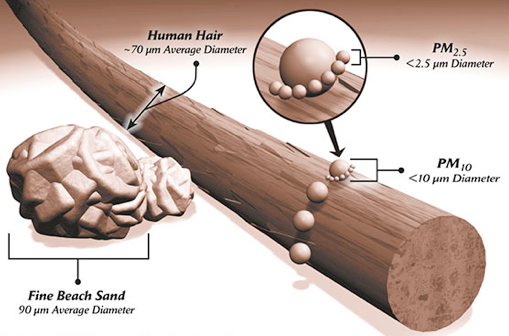
PM - particulate matter
Fine particulates smaller than 2.5 μm (micro-meters) in diameter get deep into the lungs and are implicated in health risks for populations exposed day in and day out.
Regulations established in the NAAQS require urban areas to keep 2.5 μm particle concentrations below 15 μgrams/cubic meter. Imagine a box that measures one meter on each side. Inside that box, the weight of fine air particles smaller than 2.5 micrometers in diameter or less, must not exceed in weight, 15 micrograms.
Nano-particles
This measure says nothing about the total number of ultrafine air particles having less diameter. You could have fewer but heavier particles or many lighter particles below the 15 μg/m3 limit.
The total number of particles has been investigated as a health risk:
“Atmospheric nanoparticles are one of the air pollutants which are currently not regulated through air quality standards in any developing or developed megacities.
Up to ∼85% of total particle number (ToN) concentrations in polluted urban environments originates from road vehicles.2 More than 80% of ToN concentrations in atmospheric urban environments reside in the ultrafine size range (i.e., <100 nm in diameter) that contribute almost negligibly to particle mass concentrations.3
The particle size range below 300 nm (referred here as nanoparticles) constitute over 99% of ToN concentrations in
urban environments.2
Kumar, P., Gujar, B, Nagpure, A., Harrison, R., Preliminary Estimates of Nanoparticle Number Emissions from Road Vehicles in Megacity Delhi and Associated Health Impacts, Environ. Sci. & Technol. 2011, 45, 5514–5521.
Thus EPAs, 15 μgrams/cubic meter limit aimed at fine particulates does not measure the total number of nanoparticles in a sample and misses measuring important health data that could trigger action.
Air monitoring site selection
EPA has promulgated rules for state air monitoring site selection. They seem deliberately designed to allow location of ambient monitors away from the locations where the highest pollution concentrations and greatest numbers of people come together creating high daily exposure.
Louisville’s air monitoring network locations information is posted on the APCD website and I visited each of five Jefferson County locations that measure particulate matter to see the siting conditions.
These sites are:
West End
Southwick Community Center
3621 Southern Avenue
South End
Wyandotte Park,
1032 Beecher Avenue
Southwest County
Watson Lane School,
7201 Watson Lane
Central Highlands
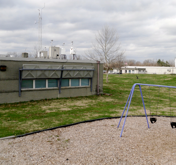
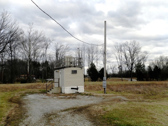
Bowman Field
2730 Cannons Lane
Rural outside Gene Snyder
Bates Elementary,
7601 Bardstown Road
See Map at right and at: <http://www.louisvilleky.gov/APCD/Monitoring/MonitoringSites.htm>
Four sites are located away from the influence of major particle emissions sources such as highways and industrial sources. They were in park-like settings surrounded by woodsy areas and with little traffic volume. The exception was Watson Lane Elementary site which sits in the shadow of the towering plume of stack emissions from Mill Creek generating unit in the far south corner of Jefferson County.
In the brief time I was in the area, subjectively the atmosphere felt unhealthy and I felt sorry for the residents living their lives in the gloom below the stacks. So the question is--does the three year average data that APCD claims supports its application for redesignation, have any meaning except to the regulators?
Three year annual averaging
After the particulate air data is gathered away from the heavy pollution areas in the city, the impact of high individual measurements is blunted by averaging the data. The data is averaged over 24 hour periods to knock off the peaks, then the daily averages are compiled into a monthly average, then the monthly averages into a yearly average, and finally compliance with the NAAQS particulate standard is based on a three year annual average.
The mathematical averaging allows lots of days of way high particulate levels that are nullified by good day readings. It seems like a way to circumvent public health protection in order to keep the door open to more dirty growth without suffering EPA mandated controls on more power plants, automobiles and industries.
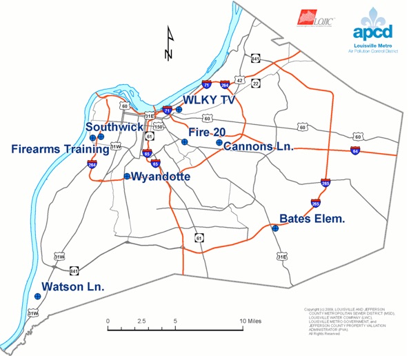
This Map is posted on the APCD website at:
<http://www.louisvilleky.gov/APCD/Monitoring/MonitoringSites.htm>
The following is from: Ambient Air Monitoring Work plan For National Core (NCore) Monitoring Station filed and online from the APCD
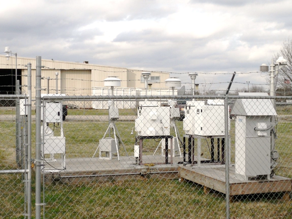
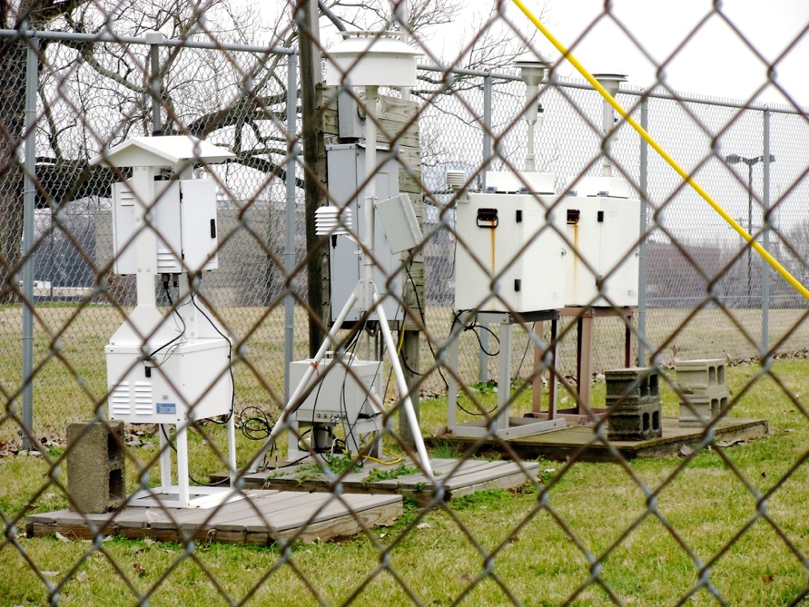
APCD has five different instruments that collect fine particulate matter at the Cannons Lane data station. See details on the APCD website.
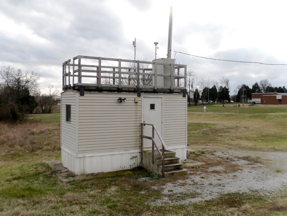
“The manual particulate samplers will be placed on a wooden deck behind the sampling shelter. The height of the inlets of the particulate samplers will vary between 2-3 meters. The inlets for the continuous particulate samplers will be placed on the roof of the air monitoring shelter with the sample inlets being 2 meters above the roof (4 meters above ground). The control units will be located inside the temperature controlled shelter.”
National Core (NCore) multi-pollutant monitoring stations-- Establish an NCore multi-pollutant monitoring station in Eastern Jefferson County at 2730 Cannons Lane. The location meets the objective for an NCore site and meets urban scale criteria for PM2.5, PM10, Ozone, and NOx. It meets neighborhood scale criteria for Carbon Monoxide.
PM2.5 Filter Method inlet height--2.4 meters above ground
Federal Reference Method utilizing gravimetric analysis.
PM2.5 TEOM Method inlet height--4.6 meters above ground
Tapered Element Oscillating Microbalance utilizing gravimetric analysis
PM10-2.5 AEM inlet height--4.6 meters above ground
Automated Equivalent Method utilizing Beta Attenuation.
PM2.5 Speciation inlet height--2.2 meters above ground
Multi-species manual collection method utilizing thermal optical, ion chromatography, gravimetric, and X-ray fluorescence analyses.
The primary purpose of speciation sampling is to study transport and formation of the secondary aerosols which make up a substantial portion of PM2.5 mass. Sulfates and nitrates are the predominant
species of concern. Integrating these measurements with trace level SO2, trace level NOY, PM2.5/PMcoarse, and enhanced meteorological measurements will provide a more complete and accurate assessment of secondary aerosol formation in the Louisville Metro Area.
PM2.5 Carbon Speciation inlet height--2.4 meters above ground
Multi-species manual collection method utilizing thermal optical and gravimetric analyses.
Approval of the application to redesignate to attainment will have repercussions on the Kentucky-Indiana Bridges Project. The Bridges project involves building transportation corridors that will see significant numbers of diesel trucks and large numbers of cars and other vehicles. If a State Implementation Plan is approved with the attainment designation, the NEPA review of the Bridges Project will have to find it conforms to the SIP. Previously a federal highway agency approval had been granted based on finding the project conformed to a transportation plan and included a PM2.5 hot spot analysis.
See: PM2.5 Project Level Conformity Determination for the Ohio River Bridges Project
“We find that the Ohio River Bridges project has met the requirements of 40 CFR 93 and is found to conform this 4th day of January, 2007. Further it was determined that the project will not have a significant impact on the PM2.5 air quality in the region and a supplement to the EIS was not required per 23 CFR 771.129 (b)”
Jose Sepulveda
Division Administrator
Federal Highway Administration - KY
Federal Reference Monitors
To be used to apply for redesignation to attainment, monitoring data results for 2.5 particulate must be obtained using instruments and procedures specified in EPA rules. Federal Reference Monitors are the established instruments but other kinds of PM monitoring instruments may yield data acceptable to EPA under certain circumstances.
TEOM is an alternative PM monitoring
PM2.5 Tapered Element Oscillating Microbalance Procedure
Washington State Dept. of Ecology
May 2000.
<http://www.ecy.wa.gov/biblio/0002007.html>
What is a TEOM particulate detector?
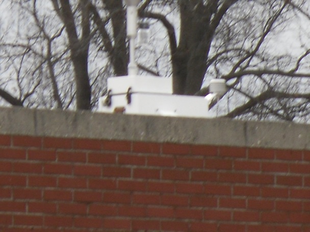
The first step of TEOM operation is particle separation, which occurs by drawing a controlled volume of air (16.67 L/min) through a cyclone inlet. Figure 1.1 is a schematic drawing showing the cyclone head of the PM2.5 sampler. It depicts the cyclone head that removes particles greater than 2.5 mm and allows 2.5 mm in diameter and smaller
particles to be collected on a Teflon® coated glass fiber filter surface. The design flow rate through the inlet is 16.67 L/min. An alternative inlet head can be used with the approval of Air Monitoring Coordinator and Quality Assurance Coordinator at Dept. of
Ecology. At the exit of the inlet, the flow is split isokinetically into a 3.0 L/min and a 13.67 L/min air stream called the main flow and bypass flow respectively. The main flow, which contains the analyte fraction of particulate is sent to the instrument’s mass transducer.
The mass transducer in the sensor unit has a thin, hollow ceramic tapered tube fixed at the downstream end and a filter attached on the upstream end. Figure 1.2 is schematic diagram of the mass transducer. As air is drawn through it, the element oscillates like a
tuning fork. The frequency of oscillation is dependent upon the physical characteristics of the tapered tube and the mass on its free end i.e. the filter. As the filter progressively loads with particulate matter, the oscillation frequency of the element changes
proportionally. The sensor unit computes the oscillation frequency into a particulate
concentration by dividing the mass rate by the flow rate.
To minimize a bias caused by atmospheric moisture, the sample stream entering the TEOM sensor unit is heated to minimize water collection on the sample filter. As the air is drawn into the TEOM, the sample stream (main flow) is heated at the base of the air
inlet (Air temperature).
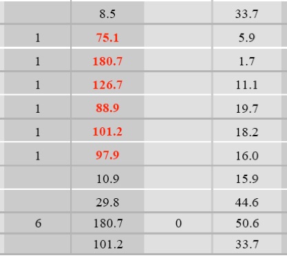
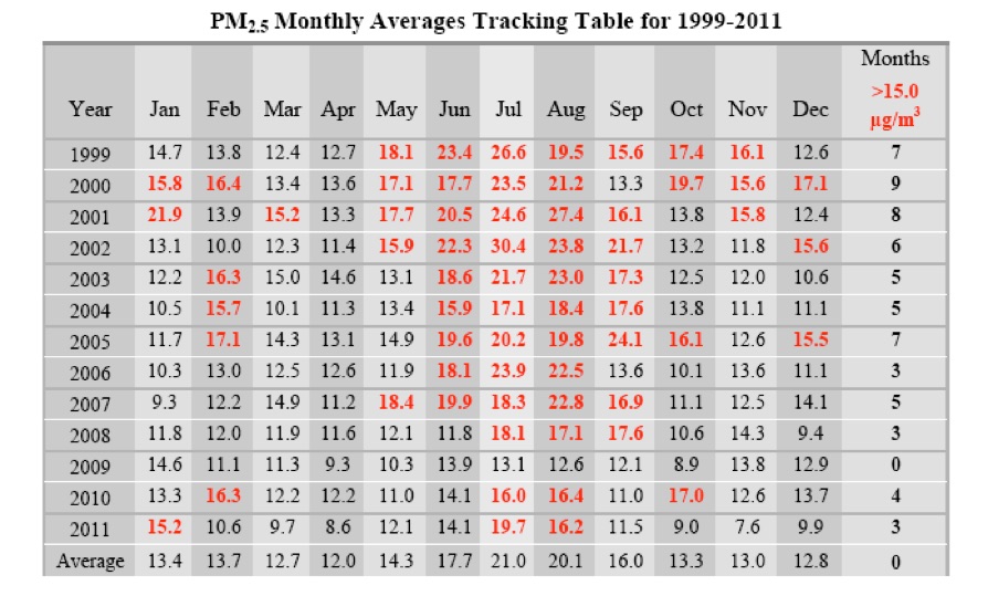
The data record for PM 2.5 monitoring in Jefferson County shown below, demonstrates months of average particulate data that exceed the 15 micrograms per cubic meter standard set for protecting public health. Thus in monitoring sites deliberately located away from pollution hot spots and intended to broadly measure urban background particulate levels, the averaged data shows problems. Six months in the last two years exceeded the 15 μg/m3 limit.
June through September are historically bad indicating summer volatile chemical and sunlight interactions that increase particle pollution.
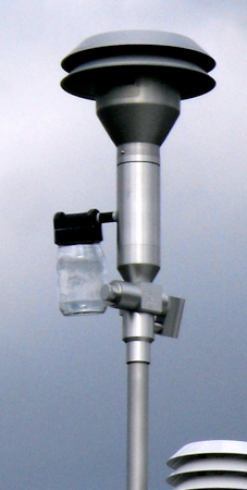
Right: the air intake of an ambient particulate measurement instrument
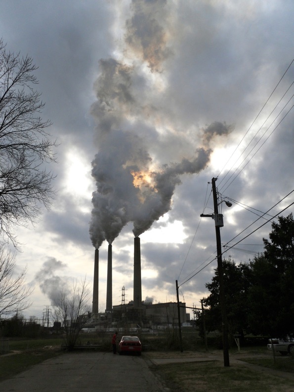
Below the Watson Lane monitoring data for SO2 shows the influence of the nearby power plant smokestacks. However the particulate matter data does not also show a great difference compared to Cannons Lane. This appears suspect, and the PM 2.5 monitoring is not up to the NCore standards of the Cannons Lane station with its multiple detectors.
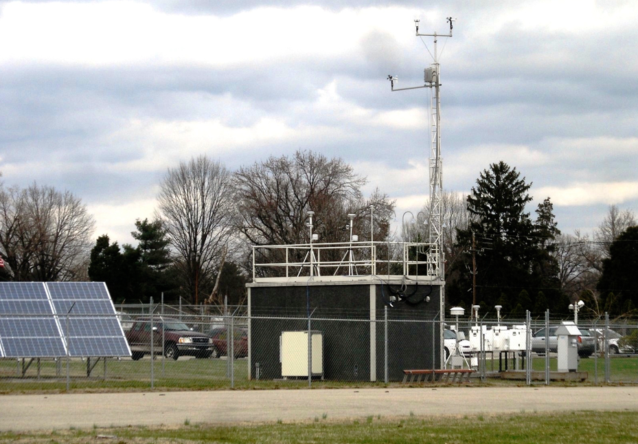
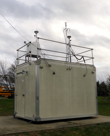
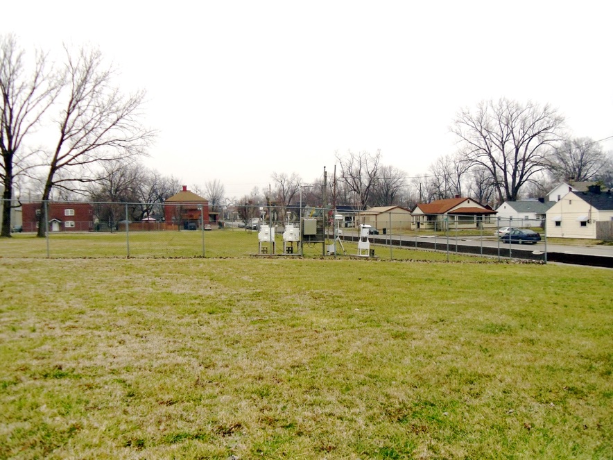
The Cannon’s Lane station is an NCore or National Core Monitoring Station. Its placement 180 meters from I-264 is designed to avoid hot spots and give a representation of urban-wide background particulate matter concentrations.
The Watson Lane Elementary station below LG&E’s Mill Creek generating plant.It has a TEOM particulate collector and is a State and Local (not NCore) Air Monitoring Station.


SO2 near the power plant
Sulphur dioxide emissions data from the Watson Lane and Cannons Lane data stations show the influence of the Mill Creek coal fired generating plant on the Watson Lane area air quality.
An SO2 excursion occurs when a measured 1-hour average is greater than 75ppb (parts per billion). As shown by the data, daily maximum readings for Watson Lane were as much as 100 ppb higher than levels of SO2 at Cannons Lane on the same testing dates. All this data was taken from the August 2011 data report available for download from the APCD website.
Obviously, location of the air quality monitoring station away from major pollution sources produces lower level data that does not represent the experience of large numbers of the population that are daily living and working near hot spots.
APCD represents the data from the Cannon’s Lane station as representative of the ambient air concentration on an urban wide scale.
“Area Representativeness:
The air monitoring equipment at the Cannon’s Lane NCore station is specifically located at the urban and neighborhood scales. These scales are generally the most representative of the expected population exposures that occur throughout metropolitan areas.”
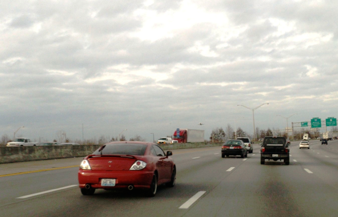
Traffic corridor hot spots
Most people may spend their entire day running up and down the highway sucking in heavy clouds of fine and ultrafine particulate matter that are stirred up and emitted by vehicles. The relevance of ambient background air quality data that only a few people enjoy, is questionable. More helpful would be monitoring results that identify hot spots and maps that show color coded contours of high pollution areas. Such maps would highlight traffic corridors.
In one view, a road while also functioning as a transportation network, is also a pollution distribution network. Thousands of tons of exhaust combustion gases, carbon particulate, brake linings, rubber tire wear particles, metallic dust from other mobile components are shed as fine or coarse particulate matter and float suspended in the air that we breathe as we fly to our next appointment. The cars flying past whip up the dust and resuspend particulate into the air. Traffic corridors have unhealthy levels of particulate matter that may be several multiples of ambient background concentrations as presented by Louisville’s monitoring stations.
“Major hotspots with respect to particle pollution are commonly observed alongside major highways. The contributors to elevated concentrations include regionally transported pollutants, pollutants from within the city itself and emissions on the adjacent highway.
[T]he roadside incremental concentration is made up not only of particles from the vehicle exhaust but also from tire, brake, and road surface wear and from resuspension of road dust by the action of passing traffic.”
Harrison, R., Beddows, D., Dall’Osto, M., PMF Analysis of Wide -Range Particle Size Spectra Collected on a Major Highway, Environ. Sci. & Technol. 2011.
“ The current management paradigm has focused on the relationship between ambient air pollution levels and health effects at the regional scale. However, impacts are realized by individuals and inequitably distributed across populations.”
Gouge, B., Ries, F., Dowlatabadi, H., Spatial Distribution of Diesel Transit Bus Emissions and Urban Populations: Implications of Coincidence and Scale on Exposure, Environ. Sci. & Technol., Vol. 44, No. 18, 2010.
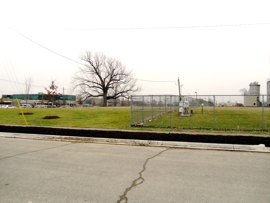
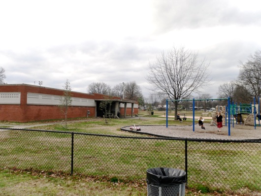
Southwick Community Center station is a SLAMS, State and Local (not NCore) Air Monitoring Station mounted on the roof of the building.The building is surrounded by park area.
Looking past the Southwick Community Center station towards I-265 beyond the row of trees in the distance. Rubbertown on the Ohio River sits across the interstate.
Wyandotte Park, 1032 Beecher Avenue
a SLAMS designated ambient PM 2.5 monitoring station that has been vandalized repeatedly and is going to be closed.
Bates Elementary,
7601 Bardstown Road
Mutat Res. 2006 Nov-Dec;613(2-3):103-22. Epub 2006 Sep 1.
Toxicological assessment of ambient and traffic-related particulate matter: a review of recent studies.
de Kok TM, Driece HA, Hogervorst JG, Briedé JJ.
Source
Department of Health Risk Analysis and Toxicology, Maastricht University, P.O. Box 616, Maastricht, The Netherlands. t.dekok@grat.unimaas.nl
Abstract
Particulate air pollution (PM) is an important environmental health risk factor for many different diseases. This is indicated by numerous epidemiological studies on associations between PM exposure and occurrence of acute respiratory infections, lung cancer and chronic respiratory and cardiovascular diseases. The biological mechanisms behind these associations are not fully understood, but the results of in vitro toxicological research have shown that PM induces several types of adverse cellular effects, including cytotoxicity, mutagenicity, DNA damage and stimulation of proinflammatory cytokine production. Because traffic is an important source of PM emission, it seems obvious that traffic intensity has an important impact on both quantitative and qualitative aspects of ambient PM, including its chemical, physical and toxicological characteristics. In this review, the results are summarized of the most recent studies investigating physical and chemical characteristics of ambient and traffic-related PM in relation to its toxicological activity. This evaluation shows that, in general, the smaller PM size fractions (<PM(10)) have the highest toxicity, contain higher concentrations of extractable organic matter (comprising a wide spectrum of chemical substances), and possess a relatively high radical-generating capacity. Also, associations between chemical characteristics and PM toxicity tend to be stronger for the smaller PM size fractions. Most importantly, traffic intensity does not always explain local differences in PM toxicity, and these differences are not necessarily related to PM mass concentrations. This implies that PM regulatory strategies should take PM-size fractions smaller than PM(10) into account. Therefore, future research should aim at establishing the relationship between toxicity of these smaller fractions in relation to their specific sources.
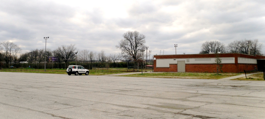
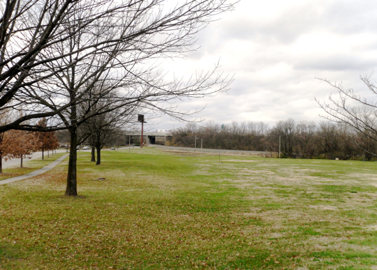
The Jeffersonville monitoring station is located ah half mile from the I-65 freeway in the far distance in the west looking picture taken 1-20-2012. Walnut street is in the foreground.
Barret Avenue
Station
Jeffersonville
Station
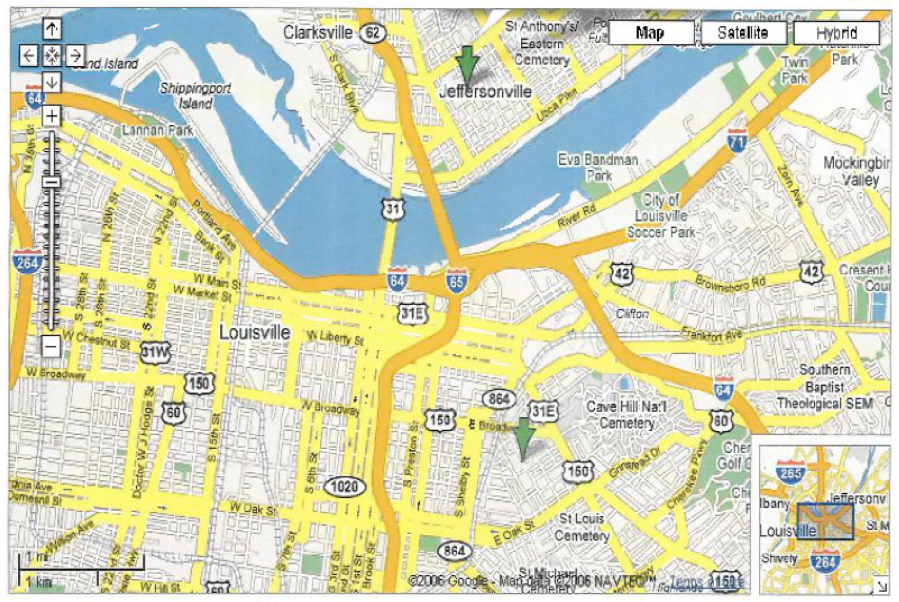
“The Barret Avenue monitor (AIRS-ID number 211110048) and the Jeffersonville, Indiana monitor (180190006) (above) are the only monitors in reasonably close proximity to the ORB project; both monitors are about 1.3 miles from the center of the downtown project site. The Barret Avenue monitor annual design values have dropped by 8 percent since 2002; however, it is still slightly exceeding the annual standard with a 2003-2005 annual design value of 15.3 ug/m3. The Jeffersonville, Indiana monitor is exceeding the annual standard with a 2003-2005 annual design value of 16.5 ug/m3. With the prevailing winds in the area from the southwest, the Jeffersonville monitor may be picking up river barge traffic emissions, industrial park emissions, and downtown Louisville area mobile source emissions leading to the high design value. Exhibit 9 shows a more detailed map of the downtown project areas with the Barret Avenue and Jeffersonville monitor locations depicted.”
In the same document, the KY Transportation Dept in reviewing the project for causing possible PM violations, talked about the Barrett Avenue and Jeffersonville, IN ambient air quality monitoring stations and their locations contributing to higher average readings. The APCD has closed the Barrett Avenue monitoring station and relocated to Cannons Lane.
Ultrafine Particulate --UFP
Ultrafine Particulate Pollutants Induce Oxidative Stress and Mitochondrial Damage
<http://www.ncbi.nlm.nih.gov/pmc/articles/PMC1241427/>
These findings may be of importance for PM regulation. Currently, the manufacture of cleaner combustion engines relies on mass output standards but do not consider the output of large numbers of UFPs, which have very low mass. Our data show that UFPs are more potent than PM2.5 and PM10 that contribute the majority of mass in the HO-1 and DTT assays. It may be necessary to consider standards based on particle number instead of mass if further studies confirm the differential toxicity of UFPs. Further research to more fully characterize the toxicity of UFPs in relation to particle number, surface area, and
chemical composition is needed.
The Jeffersonville, Indiana monitoring station in a lot off Walnut Street